The
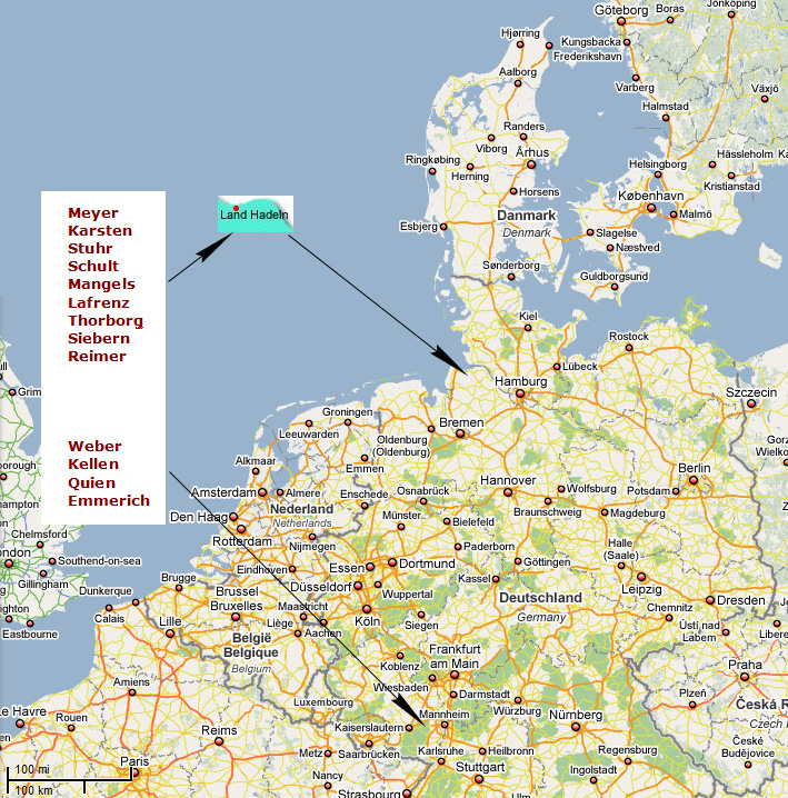
Land Hadeln is a 22 km to 25 km broad marsh-area close to
the estuary of the River Elbe near Cuxhaven on the North Sea.
Embedded between the Hohe Lieth in the west, the Wingst and
the Westerberg in the east, the Handeln Marsh stretches about
25 km in a southerly direction as far as the Bederkesa Moor
Geest. Hadeln Bay belongs to the sea-marsh area of the Elbe-Weser
region, which formed due to marine conditions.
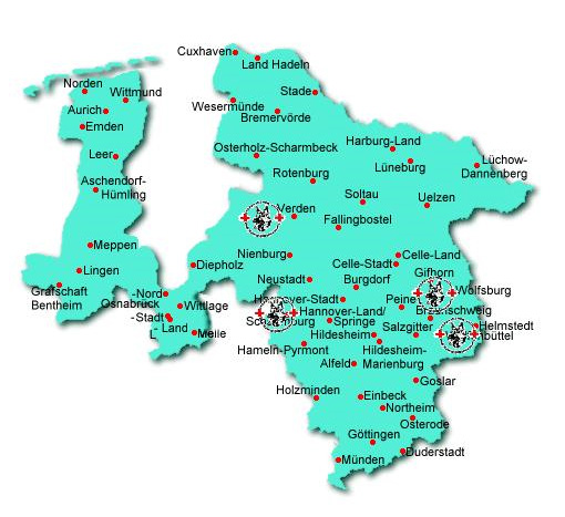
...The
main focus of settlement is on the highland which is on average
about 15 m above sea level. The Hadeln low lying land, which
roughly begins in Neuenkirchen, goes down to less than 0.5
m under sea level and, due to the lack of drainage, is very
marshy, especially on the Geest edges. This area is surrounded
by a ring of lakes, such as the Flögeln- and Bederkesa
Lakes as well as the Balk Lake.
...The
coast line of the North Sea has changed frequently in the
course of the Earth’s history. Towards the end of the
Ice Age, roughly 10.000 years ago, another low-land bay
existed on the southern Elbe estuary. Due to the rising
sea level, tidal change led to the flooding of Hadeln Bay
at high tide. At low tides the materials transported by
the water were deposited, so that the marsh grew slowly
higher over the course of millennia.
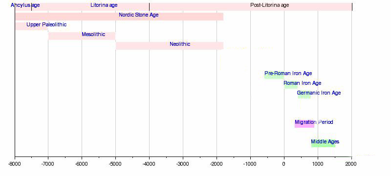
http://upload.wikimedia.org/wikipedia/en/timeline/53da2d7b59f477901e6ad723b95999c9.png
The first settlement traces go back to the Palaeolithic
Age and are restricted to single finds of flint artefacts,
like the flint found in Wanna and from the Wingst. They
are assigned to the Upper Acheuléan period, chronologically
to the end of the penultimate Ice Age, and are found in
connection with Neanderthal man.
Unlike the Palaeolithic, a number of Mesolithic finds are
known in the Elbe-Weser area. They are partially from the
neighbouring regions of the Land Hadeln, for instance from
Neuenwalde and Hemmoor-Westersode close to the Wingst.
With
the beginning of the Neolithic period (roughly 3000 BC) the
human impact on landscape in the Elbe-Weser area increases.
One of the discernible changes in the natural landscape is
the introduction by the humans of farming and livestock breeding.
This phase of land settlement in North Germany is most obvious
in the Elbe-Weser area of Flögeln, north-west of Bederkesa
on the Geest. Pollen diagrams from kettle-hole bogs indicate
the existence of grasses and heather in a clearing in the
forest suggesting that grazing went on. Spelt and hull-less
barley as well as some emmer were grown as cultivated plants.
At the site of Flögeln there are the outlines of houses
from the Neolithic Funnel Beaker culture (Trichterbecher Kultur;
TRB), which provide information about the settlements of that
time. Today the Neolithic burial places stand out in the landscape,
and numerous examples were erected in the Land Hadeln. including
those of Wanna and the Ahlenmoor. The burial places there
were partially covered by the moor and are therefore well
preserved. The cause of the growth of peatland at this time
was the rise of the ground water level, which made the formation
of the raised bogs possible.
For the Bronze Age there are many archaeological sites in
the Elbe-Weser region. In particular tumuli and urn cemeteries,
as well as some settlement traces, are worthy of mention.
Nevertheless, there has been a lack of major settlement excavations.
The man-made landscape hardly changed in the pre-Roman Iron
Age either. However, there is a considerable increase of settlement
activity, which intensifies in the northern Elbe-Weser area
in the following Roman Imperial/Migration Period. This is
also apparent in the beginning of the terp (settlement mounds)-building
in the marsh around Christ's Birth, as well as in the continued
settlement in the Geest-areas, for instance, in Flögeln-Eekhöltjen.
Up to that time the settlement of the marsh was subject to
variations in the sea level. This also holds true for the
first small Iron Age settlements on the sandy ridges, but
only with the beginning of terp-building was permanent settlement
possible in the flood-endangered areas.
There are large old village-terpen in the west of the highland
of Hadeln between Lüdingworth and Dörringworth,
as well as on the Medem between Neuenkirchen and Otterndorf,
and to the east of Otterndorf in Westerwörden. The terpen
were settled until the 5th century and today they still rise
above the surrounding areas by a few metres. They reflect
the coastline of the North Sea or the shoreline in the tidal-area
of the particular river-system during its settlement-phase.
An
early medieval re-settlement, like the one which is documented
for the neighbouring coastal land of Wursten, by a new terp-building
phase in the 7th/8th century, can probably also be assumed
for the Land Hadeln. Similarly, the question is still open,
as to when the low lying land was cultivated for the first
time. An indication of this is in the setting up of linear
settlements, starting in the 12th/13th century on the north
and east edge of the Ahlenmoor, from which the moor was cultivated
bit by bit by peat-cutting.
With the medieval dyke-building the terpen lost their function
as a protection from storm floods. It is assumed that the
first medieval winter-dyke in Hadeln was set up parallel to
the coast in the 12th century (“Hadler Seebanddeich”).
It was presumably planned by Dutch colonists. A comparable
development has been passed down to us for the Hamme-Wümme
depression near Bremen in a document from 1113. Today there
are still sections of old dykes, in separated sections,preserved
near Otterndorf. However, they did not belong to the continuous
winter-dyke, but where water divides between areas of different
drainage direction.
It was only after 1469 that dykes were built at the mouth
of the Medem. The church of Otterndorf, founded in the 12th
century, was up to the middle of the 15th century in the area
beyond the outer dyke. All in all there were 12 parishes in
the Land Hadeln. The town of Otterndorf had a prominent position
in the Elbe-Weser area for several centuries. In the core
of the old town the original arrangement of the terp of Otterndorf
is still recognizable.
The
Reformation asserted itself in the Elbe-Weser area in the
middle of the 16th century and found quicker acceptance in
the Land Hadeln, which was under the supremacy of the Dukedom
of Saxony-Lauenburg, than in the lands under archiepiscopal
rule. After the losses of the Thirty Years' War the need rose
for ecclesiastical furnishings, which in the 17th and 18th
century often came from farmers’ donations. The churches
in Hadeln in particular reflect the economic prosperity of
the large farmers, and this is also evident in the development
of splendid buildings combining living and working quarters
in the Hadeln highland. The churches of the Land are also
called "farmers’ domes" (Bauerndome).
In
the second half of the 17th century, further settlements were
built on the peatland edges, and the intensified deforestation
of the Geest led to an increase in peat-cutting so that heating-fuel
could be obtained. In this cultivation-phase Westerende, Mittelteil,
Steinau-Westerseite and Medemstade came into being. The development
of new land improvement techniques also ameliorated the conditions
for agriculture in the low lying land. Suitable meadowland
could now be transformed into farmland. While the settlements
in the low lying land, such as Bülkau, Oppeln and Steinau,
mainly represented the type of closed marshland village with
relatively closely positioned houses, the linear settlements
of the northern highland, such as Altenbruch and Lüdingworth,
take the form of a loose structure of detached farms.
From the early Modern Times the Land Hadeln was regarded as
a granary, which supplied grain to Hamburg in particular.
An important upswing in agriculture was closely connected
with cultivation of rape-seed from the middle of the 18th
century. Today there are remnants of the former field-use
left in the low lying land.